The history of Ossenzijl in nature reserve Weerribben Wieden is beautifully depicted annually by Local Interest Ossenzijl with historical prints throughout the village. Ossenzijl probably owes its name to the Osse family, who at the time managed a lock. A lock was formerly called a Zijl. Nowadays there is no longer a lock in use in the small town of Ossenzijl (with only about 500 inhabitants).
Local interest Ossenzijl provided the old prints of Ossenzijl free of charge - many thanks for that!
1927 Hoofdstraat Ossenzijl direction Oldemarkt
Sunday rest in the Hoofdstraat of Ossenzijl at the beginning of the last century. The house with the wooden facade is the farm of Koendert Zijlstra. There he started the Free Mission Church in 1863. Behind them is now their church building that was opened in 1918. The rear part of the farm is now a Bible school with the appropriate name "The Origin".
The building of the Vrije Zendingsgemeente is protected because of the single-keyboard organ from the mid-18th century of unknown origin.
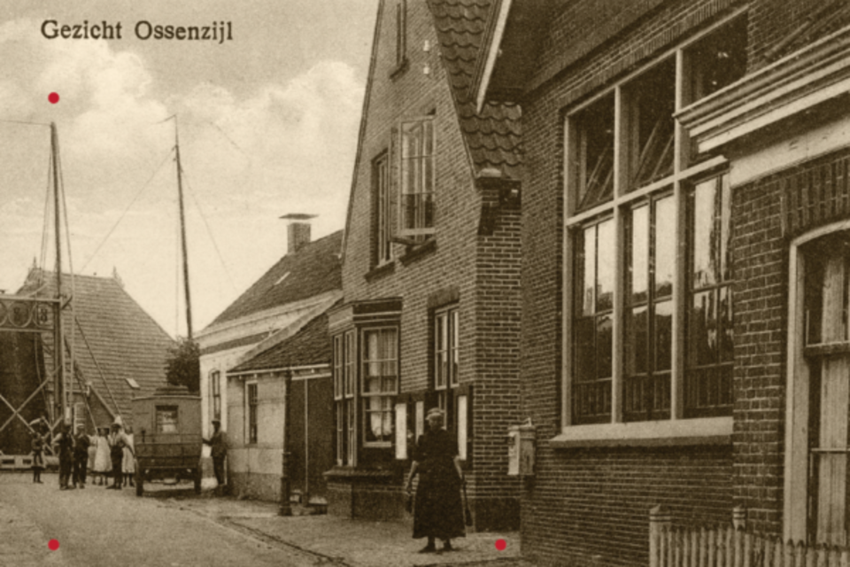
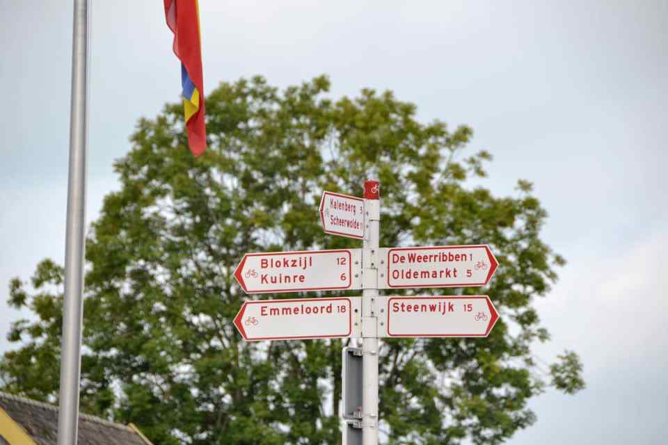
1927 Hoofdstraat Ossenzijl direction Kuinre
In 1927 there was almost no question of car traffic. The first car drove in Ossenzijl in 1912 and was driven by the notary of Oldemarkt. It was dark here at night - there was no street lighting yet. Until 1925 the street lighting in the Hoofdstraat consisted of 4 oil lamps. Then the electric light came. Aaltje Schaap-Veen (with a hat) is standing in front of her door.
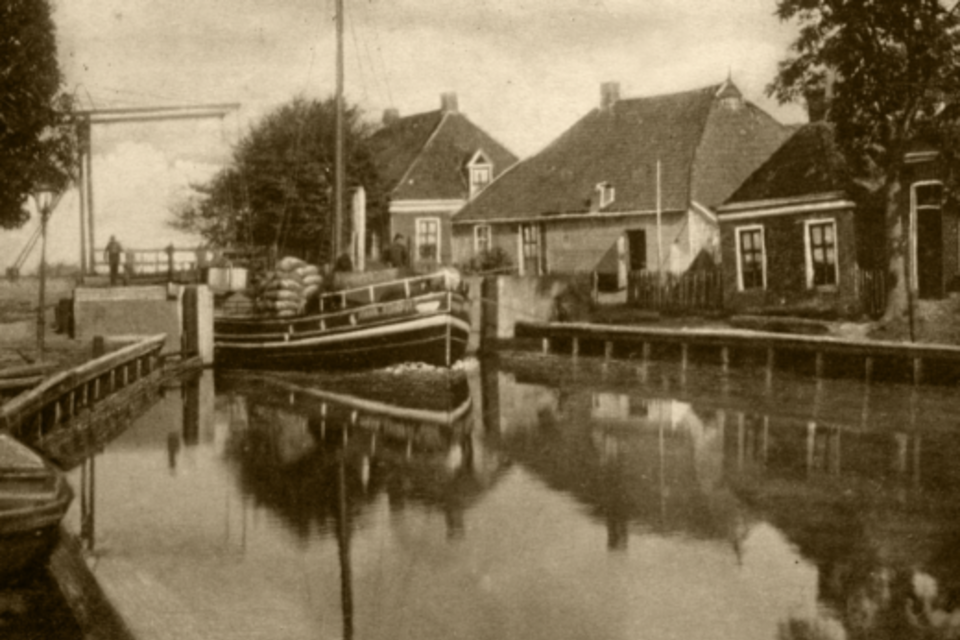
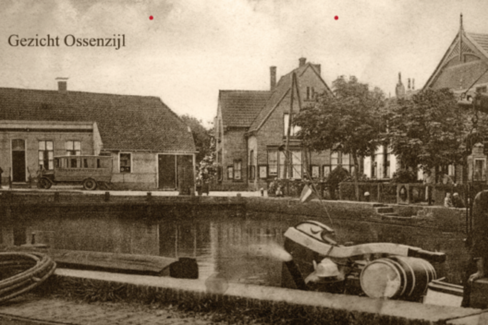
Motorkade
This was the landing place of the Minor and the Major, the two turnboats with which Joontjes took care of the daily transport of people, goods and news to Steenwijk and Blokzijl in the first half of the last century. This function was then taken over by road traffic.
The barge ship Minor van Joontjes was en route from Ossenzijl via Wetering to Steenwijk for so long that a handy knitter could knit a pair of socks during this trip.
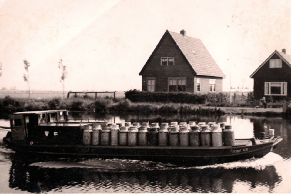
Melkboot - Milk transport Marten Wiltens
The Steenwijk-Ossenzijl canal was opened in 1937. Agricultural land became available as a result of the reclamation of areas around Ossenzijl. A land consolidation plan was drawn up in 1951. In 1961, the concept of “wild land” disappeared for good, but the region was far ahead of the purchase of a nature area and nature conservation for nature protection and recreation.
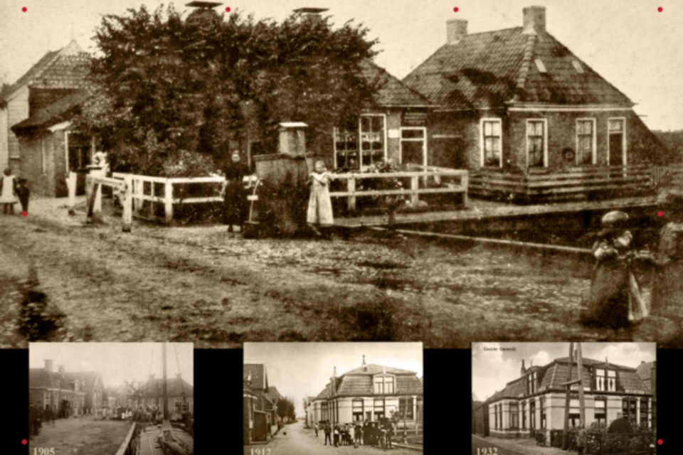
Café Stuitje Ossenzijl around 1900-1905-1912 and 1932
Often the peat bosses also had bars and shops. This is also the case with Harm Stuitje, who already operated the café accommodation and shop “Stuitje” around 1900. He was also the great farmer of Ossenzijl. The photos from 1905 and 912 still show the village pump and the toll booth. In the photo from 1932 there are already electricity poles. They were installed with the arrival of the electricity in 1925.
At the Kolk Ossenzijl ca 1925
The name Ossenzijl comes from Ossies Siel. In the low land of the head of Overijssel, the water level must be kept artificially low against flooding. At the beginning of the 15th century, the Osse family therefore built a “small sile”, a small drainage sluice, here in the dike. Around 1800 this lock was made suitable for larger ships. This is traditionally the center of the village and all the activity. Tolls were levied here and there was a landing place for ships, here were café Prins (now Kolkzicht) and the café & lodging annex shop of Stuitje. In front of Café Prins is the bus from Colle, in the direction of Oldemarkt and Steenwijk.
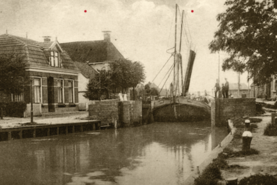
Ossenzijl lock
Through the lock and the bridge mainly ships with peat and reed and further turn ships went to Leeuwarden, Heerenveen, Steenwijk, Oldemarkt and Blokzijl, among others. "Sand hunters" sailed throughout the year: ships with sand and gravel. The house on the left with the chimney is Café Prins (now Kolkzicht) and the Joontjes oil trade on the far left.
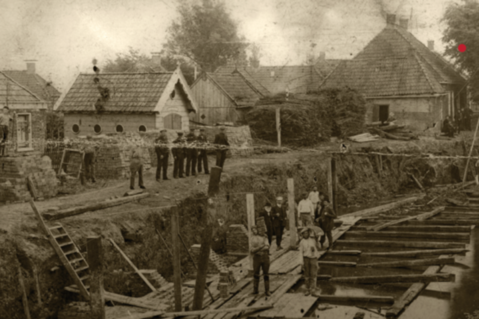
Demolition Sluis Ossenzijl 1928
The lock was demolished in 1928 and the original reason for the village disappeared. A new bridge was also built and the walls of the pit were rebuilt. The forest branches in the background were not building materials. Bakker Tietema - in the big house with the chimneys - used them for his bread oven.
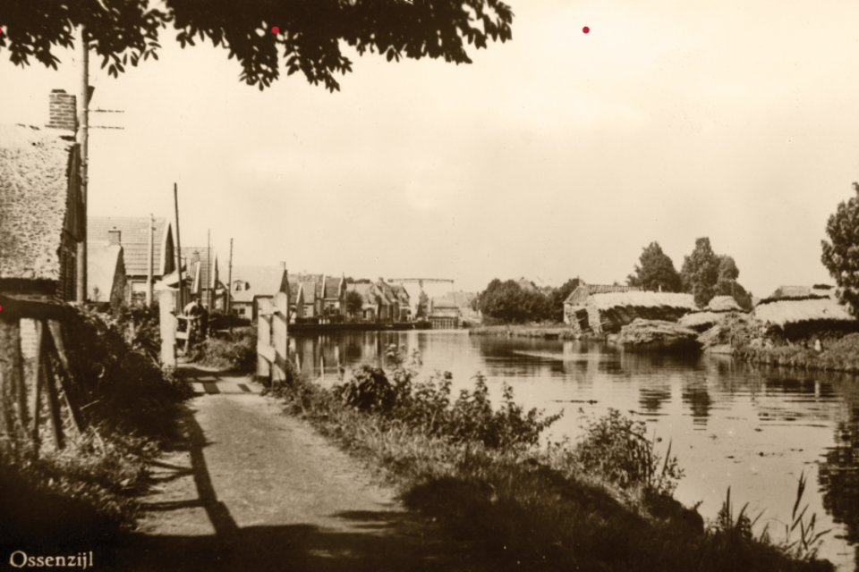
Oudeweg 1930 / ca 1950
The Kalenbergergracht (formerly known as Oudeweg) was dug around the year 1200. Later the canal was very important for the removal of peat and reed. Around 1900 a large number of farmers, peat diggers, reed cutters and fishermen lived along the Kalenbergergracht. The footpath was constructed in 1902. Before that time, all transport took place over the water. Only from the 1950s got water, electricity, sewerage and natural gas here.
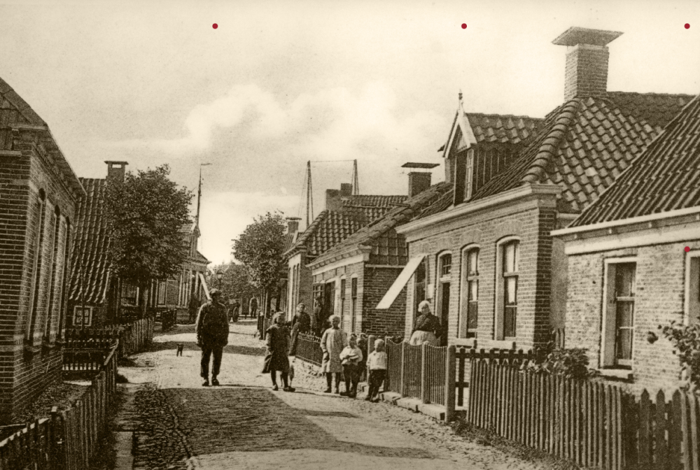
Hoofdstraat Ossenzijl 1900
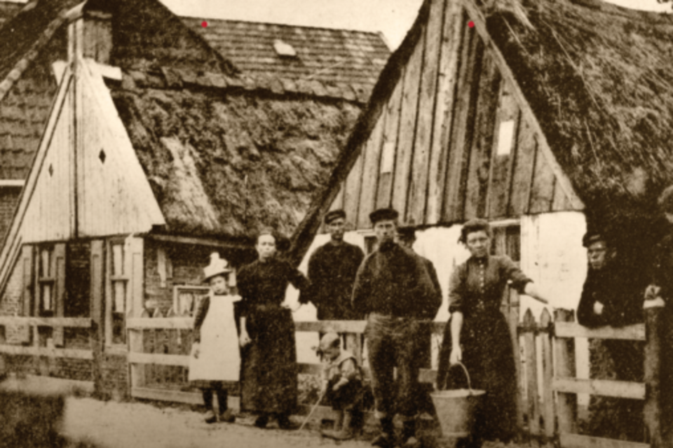
It is not for nothing that around 1900 someone described Ossenzijl as "a very humble hamlet, largely populated by peat workers and fishermen, whose homes claim little more than the name of huts."
Hoofdstraat Ossenzijl 1927
At the front right is the Public Primary School. Only since the introduction of the Compulsory Education Act in 1901 was this school well attended.
OSSENZIJL
Below you can view the photos of the village Ossenzijl - in nature reserve Weerribben Wieden. From Ossenzijl there are beautiful cycling routes and sailing routes both towards Friesland and the Frisian Lakes as well as Weerribben Wieden National Park with places such as Giethoorn, Blokzijl, Muggenbeet, Wanneperveen, Blauwe Hand, Kalenberg, Sint Jansklooster and Vollenhoven.